The Hunters Lap of Australia
"Gone Bush"
Australian National Park Visits (UPDATED)
LAST UPDATE: July 02, 2016
Australia has more than 500 National Parks covering an incredible 30 million hectares – almost five per cent of the country.
And whilst we have being trying to visit our fair share of these, we have had several travellers we’ve met on the road and a few of our subscribers ask us which National Parks we’d suggest to visit &/or stay from our experience of staying in some of them. As there are many we’ve visited so far on our trip, it’s a fine question …so we’ve written a high-level description on each of those parks we have visited and or stayed within to hopefully assist those researching which national parks of these they most like to visit.
Background
Whilst there are many wonderful gazetted state forests and state reserves to explore in all states and territories, we have only recorded a list of Australian Gazetted National Parks we have either visited, stayed overnight, or explored at some rudimentary level on this trip that *could* be used for other travellers planning a trip similar, or planning a trip to a specific NP we’ve mentioned or blogged about. This said, the NP’s noted below are not descriptive park notes or trip logs, they are not an exhaustive list either. These are no more than basic thoughts, considerations and suggestions from the NP’s we’ve spent a little time in that maybe useful to some …as well as serving us as record of our NP visits on our trip.
The list is in chronological order of each park visit we’ve done, all with map coordinates, week & month of our visit, and with an image or link to a blog with further information.
Parks Passes Tip: Most National Parks charge a visitor fee per vehicle – typically anywhere from $8-$14 per entry. This is particularly the case in Western Australia (WA) and New South Wales (NSW). Most other states we visited on this trip the cost of entry did not exist or was random at best, such as the Northern Territory.
 As we planned to spend the majority of our trip in Western Australia we decided early on to purchase an annual WA National Parks Pass (here’s a copy of our’s with the Numbat photo to the right) to avoid having to worry about the right $money (often an honesty unmanned cashbox system) at most NP entrances, plus you will save money if planning on visiting as many parks as we have.
The pass is a bargain $88.00 and permits you to visit all NP’s in WA (with exception of only two) as many times as you like within 12 months of the date of purchase. (A no brainer in our case).
Lastly, we have also split Western Australia’s National Parks into three state regions; North, Mid and the South West and all photo’s used in this blog and the rest of this site are the property of the Hunters and are ©copyright. (Please ping us if you wish to reuse any photo’s from this site)
*** Disclaimer ***
Please read and carefully note: All stated thoughts and suggestions in this blog pertaining to each National Park visit are from the author, and the author alone. They are based from our visit or stay, time of year of each visit, all of which is important for you to take note of if deciding to use this information for your own trip planning purposes. Please especially observe the dates of our visits so as to properly compare if these are favourable temperatures and weather conditions for your preferred time of travel. In doing so, you should only use this information as a “O N E-S O U R C E-I N-M A N Y“ in an effort to purposely plan specific NP visits for your own journey.
Please also note: Some national parks in the more remote regions of WA (such as Purnululu NP) require you to register at a S I G N-I N & S I G N O U T at a park rangers hut whether you have an annual or day pass or otherwise. Please make sure you follow this procedure for obvious due care and safety reasons so the park ranger(s) know who to come looking for, and approximately where you are going to be, in the case of emergency or accident when they notice you have not returned to sign yourself out of the park. Maybe a pain in the A@$e to some, but could also save your life – only takes two-three minutes.
Okay, lets get started…
National Park Trip List
Legend
* B L U E * NP name highlighting donotes some of our most favoured NP’s we have visited and if you have a liking for flora or fauna, wonderful vistas and landscapes, perhaps even good hiking, try to see some of these.
* R E D * highlighting are must see NP’s in our opinions if you’re travelling through or near that region, make every opportunity to see the NP in question if possible.
* M A P C O O D I N A T E S * example of a stated NP appear like this example 24.2517°S 131.632°E or like this decimal 25.312222222222°S 131.01861111111°E Also note when you click coordinates you will be asked to choose your preferred map – there are several to choose from.
* I M A G E S and B L O G S are also linked in light blue and underlined and will open a new tab on your browser when clicked.
New South Wales
Pilliga National Park (Baridine, NSW) 30°57′0″S 149°04′0″E (Mid June 2016)
 If you like large areas of rugged scrub, amercing yourself in total isolation and have a capable 4WD, then Pilliga is a must visit for you. Commonly known as the Pilliga Scrub, the park constitutes some 3,000 km2 of semi-arid woodland in temperate north-central New South Wales and is the largest such continuous remnant in the state. The forest is located near the towns of Narrabri and Baradine where we based ourselves and did 3 consecutive day trips into the different sections of the forrest. It a wonderland with lovers of flora and fauna with over 900 species of plants recorded. For us though it was about the birds and it was a delight following several well-defined bird routes out of Baradine.
Click here for more information in our blog on the visit.
***
Warrumbungle National Park (Coonabarabran, NSW) – 31°17′32″S 149°00′29″E (Mid-late June 2016)
 If you enjoy experiencing dramatic landscapes and hiking amongst them, then visit this wonderfully scenic and unique park like none other in the country. We have been to the Warrumbungles many times over the years and it still captivates us each time we visit including this last visit in the dead of winter. We’ll say no more other than click here to read our Warrumbungles blog.
***
Dorigo National Park (Dorigo, NSW) – 31°17′32″S 149°00′29″E (August 2016)
Guy Fawkes River National Park (Ebor, NSW)
South Australia
*Flinders Ranges National Park (Wilpena Pound) – 31.4222°S 138.705°E , (Aug 2015)
 Although it mainly rained in our 5 day visit in late August 2015, it is still a place of wondrous beauty. Wilpena Pound especially is a fascinating large mountain range with great camping sites in two main locations with other more out of the way “free-camping” locations between Blinman and Parachilna in the many narrow gorges along this rough dry river bed road. If you like Emu’s, you’ll love this place – they are everywhere, as we found. And we all look forward to getting back to the Flinders on route to do the Birdsville and parts of the Strezlecki track come May 2016 on the tail-end of our trip. Great place for rock fossicking and flora & fauna. Although we endured mostly a wet spell in the Flinders, we still loved it and will return. (As a side trip on the eastern side of the ranges, we’ve heard only good things about Arkaroola 30°18′42″S 139°20′10″E but we ran out of time to get there so far on this trip).
***
Lake Eyre National Park (Oodnadatta track region) – 28.6689°S 137.524°E , Lake Eyre South (Aug 2015)
 You don’t come out this way looking to find trees. It is harsh arid country out this way and if not prepared, many people have become unstuck at certain times of the year. However, thats part of the attraction and the area is full of interesting earlier explorer and stockman history to follow for yourself. Beware though of the extreme temps this region can throw at you which in summer can regularly top 45, sometimes even hit 50deg C. We would love to see Lake Eyre after a season big wet and to witness the migratory bird flocks to this enormous inland lake system when in flood. A must see at anytime, but especially after large and heavy prolonged rains when the lake Eyre system fills to near capacity. The track can be rough and rather stoney in places, but on the whole a good road for what it is so get prepared, drive to the conditions, and enjoy it. We did.
***
Coffin Bay National Park (Eyre Peninsula) 34°34′56″S 135°19′19″E (Mid-Feb 2016)
 One of the smaller national park visits to-date and access is only via the township of Coffin Bay 45kms west of Port Lincoln. Quite famous for King George Whiting and Aust Salmon fishing within the non marine areas of the NP – Gunyah beach if you have a 4WD with low range.
The park is also well known for spotting birds such as Fairy Terns (Almonta Beach) and Sooty Oystercatchers (Point Avoid). We were also lucky enough to see a flock of Cape Barren Geese (~30 birds) on (Almonta Beach opposite Golden Island). Camping is available in the park at $11 per night (+ park fees) at the Yangie Bay camp site (No power, but there is WCs) and speed limit throughout the park is limited to 40Kms per hour (it will become obvious when you visit why) and please watch out for Roo’s & Emu’s – there’ lots of them.
***
Lincoln National Park (Eyre Peninsula) 34°52′04″S 135°52′11″E (Late-Feb/Early Mar 2016)
 Similar in size to Coffin Bay, perhaps slightly larger from the off-road tracks available. A small national park but much more protected in a lot of areas and with a couple of great camp grounds with the “Surfleet camp ground” we found the pick of the offerings. Right on the beach, approx 25 sites – all within a reasonably protected area. Great for fishing, bush walking and bird watching and many Emu’s. The sites are large, great for a big van, but no power. Modern Pit WCs available. In our opinion, the best remote campground (we found) on the Eyre Peninsula. Highly Recommended.
***
Mt Remarkable National Park (Lower Flinders Ranges) 32°46′53″S 138°03′46″E (Mid-Mar 2016)
 This NP is awesome. A wonderful sheltered position in the most southern area of the Flinders Ranges surrounded by a wonderful campground setting at Mambray Creek amongst very large ancient red river gums. The NP is abound with a huge variety of Flora and Fauna and Grey Kangaroos and friendly Emu’s are particularly abundant. The Mambray campground is well set up with WCs and the luxury of basic showers. There are 23 camp sites available (no power) in all sizes and we stayed in site 17 (9x9M) with a good mix of shade and sun for power regeneration if you have ample solar. To stay here you must book online and book your spot as we understand there is no way to pay if you simply turn up. The walks are great here in amongst the quartzite gorges with the Sugargum 8km return lookout walk our favourite. Click here for our blog on this park. Highly Recommended.
Northern Territory
- Uluru National Park (Ayers Rock) – 25.312222222222°S (Sept 2015)
 An Aussie icon known the world over. If you’re travelling through NT, make sure Uluru is on you’re places to visit. The BIG rock is a magical place at anytime but especially at Sunset. Sealed road all the way in from the SA/NT side, and a long red dirt road via Warburton from the WA side. There is nothing more to say other than just get there – you won’t be disappointed (apart from the camp fees)
Click here for images and blog
***
- Kata-Tjuta National Park (Olgas) – 131.01861111111°E Sept 2015)
 Same as Uluru above – 45kms apart and a symbolic must do as well. Some great walks, not too hard, and some are even in the shade of the midday sun. A beautiful spot and wish we spent a little more time here before moving onto Kings Canyon as we were on a tight schedule at this stage of our trip. A must for anyone who loves a “natural thing of beauty” and a camera. make sure you bring enough water.
Click here for images and blog.
***
- Watarrka National Park (Kings Canyon) – 24.2517°S 131.632°E (Oct 2015)
 A little out of the way but a worthy detour if you are into canyons, desolate escarpments and hiking. Watarrka has some fantastic hikes and walks for all fitness levels, just make sure when visiting it is in the winter/spring months to avoid the heat or start walking no later then first light as we had to in Mid-October. Bring plenty of water.
Click here for images and blog.
***
- Gregory National Park (Judbarra) – 15.6339°S 131.267°E (Oct 2015)
 I wish we had a cool break in the hot temps when we came through this NP so we could have camped but it was 42 deg and camp stays are remote, dusty and without power. The Fitzroy River area escarpments of the NP are quite spectacular from our casual stops and the colours were amazing – even in the midday harsh light. In our opinions, this is a winter-only visit unless you cope well in prolonged high temps that often occur in this region. Water is also plentiful here so be sure to pick a camp ground or caravan park closely to the Fitzroy River and enjoy. *Beware of Crocs* (like this guy in the image above we stumbled upon) as they are not hard to find, and if you don’t find them …they can easily find you!!
***
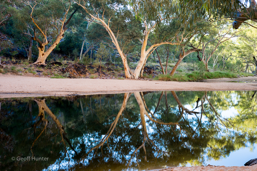
- West MacDonnell Ranges National Park (Alice Springs Region) – 23°38′57″S 133°08′15″E (Late March 2016)
 Close to Alice Springs, amazing scenery, beautiful colours, the world renowned Larapinita walking trail, permanent swimming holes in a couple of the gorges (Orminston and Redbank) numerous camping areas. (Orminston Gorge being the pick for us or camp out at Redbank if you wish to get away from it all) Glen Helen has cabins and powered sites for caravans, and did we mention the scenery. The park is a bush walkers paradise as is for landscape photographers. There is only fuel at Glen Helen (135kms from Alice) and you must be self-sufficient in everything else for your stay including drinking water. Standly Chasm we thought was a bit of a $rip-off, however everything else in the park is wonderful to see and enjoy. We stayed 4 day and could have easily extended to a week if we brought more drinking water.
Click here for more information on the area and our blog
***
- Nitmiluk National Park (Katherine Gorge) (Katherine, NT) – 14°18′44″S 132°25′23″E (Early April 2016)
As with all “top-end” national parks, there is the wet and dry season. They are very different times of the year and all park in the top end will take on a different look. Our time was just after the wet season (April) in that transition period. It was also after one of the driest wet seasons for the last 25 years so various falls were not at there usual peaks. Nitmiluk has two different park aspects; 1. Katherine Gorge 14°18′44″S 132°25′23″E where there is cruises, swimming, canoeing and croc shows on offer if you like those types of things and; 2. Edith falls 14°10′S 132°10′E which is 60kms north of Katherine. Edith falls is lovely and there is a top pool and large lower pool, which is occasionally closed (as it was when we visited) due to salt water croc threat. Nitmiluk NP is a nice park however if gorges are your thing there are better on offer elsewhere but still definately worth visiting if passing through or nearby.
***
- Litchfield National Park (Batchelor, NT) 13°16′45″S 130°52′36″E (Early April 2016)
 Make no mistake, Litchfield National Park is beautiful. It has some of the territories most spectacular waterfalls and safe (from Crocs) swimming holes on offer. But we have to be honest – Litchfield in our opinion from our visit suffers from over-tourism. Too many visitors spoil this park and the damage they are causing is horrendous. If you don’t mind crowds at Wangai and Florence falls in particular, then you’ll love it. When we were at Florence falls (on a weekday) there must have been 80-100 people at the swimming hole at the bottom of the waterfall. Bewleys holes is the same, we also visited late afternoon, the place was jammed packed with swimmers seeking every square inch of water across the multiple cascading pools. I came back the next morning at sunrise to take a few shots and there was litter everywhere, rubbish in the pools, cigaret stubs everywhere etc etc. Very disappointing to witness this type of disrespect and park management. The park is only 110kms from Darwin so traffic in/out of the park will also be high …but, be-warned.
Click here for our Litchfield NP blog
Western Australia
Northern Western Australia
*Hidden Valley National Park (Kununurra) – 15.7739°S 128.764°E (Oct 2015)
 This NP is less than 5 minutes out of the Kununurra township. It’s a hauntingly beautiful place which is also a homage to the local indigenous people of Kununurra and surrounds. It’s well set up and a great place to view a sunset or sunrise but could also be well shaded in certain areas during the day. click here to see image and here for our Kununurra blog.
***
*Purnululu National Park (Bungle Bungle) – 17.463055555556°S 128.56416666667°E (early/mid Oct, 2015)
 If you are within a long days drive of the place, go there …but you will need a proper 4WD vehicle to get in/out of Purnululu, or do a flight from somewhere remotely nearby if time is not on your side. We had to camp 50kms outside the park due to the size of our van – but camp within the park camp grounds if you can, but beware of the road in/out, it’s a beauty and breaks lots of vehicles as shown all over the road. Temps were again high (35degC at 9.45am & well over 40C by early afternoon) when we did the Cathedral walk but what a place of beauty. We would love to get back here for 3-4 days in winter as it would be much cooler and the water holes replenished. It’s a rough and remote place, so make sure you prepare – not your average NP and a definite place to remember. Click here for Blog along with a funny tourist 4WD breakdown story that we encountered along the way out of Purnululu.
***
*Karijini National Park – (Pilbara) 22.2506°S 117.976°E (Late-Oct, 2015)
Wow! This place is A MUST DO.  We stayed a week or so just before the Dales Campground was closing for the wet season and was still spectacular at the end of the dry season in every sense. If you love to immerse yourself in all things outdoorsy beautiful, natural satirised colours, truly rugged, and even meditative – get yourself here and aim for at least 5 days just to scratch the surface of this amazing NP. For images click here and here for our Karijini blog on this very special park.
Note: This park has some camping restrictions at Dales Gorge Campground (where we stayed) which typically closes for the wet (Nov-Apr) so make sure you observe the closure / opening dates if planning to come to this part of the park. The only other campground which is 37kms away from Dales is the Karijini Eco Retreat which opens all year round (subject to weather conditions), but beware, the gorges here can be very dangerous due to extreme flooding during the wet season. (We’ve seen the big wet photos and they are something truely extraordinary by any description).
Comment: We would love to come back here during the wet-season to really experience the often extreme stormy weather this park receives, especially around Jan-Feb. However it would be very uncomfortably and extremely hot and seeking temp respite in the many glorious pools Karijini has to offer may not always be an (safe) option. If you have deep’ish pockets, perhaps the Eco-retreat is a better option in the summer time but don’t expect air-con. Peak season is from April-Oct when the temps are significantly milder during the day and often cool to cold at night and both campgrounds often fill to capacity.
As a side-trip suggestion: 21°16′24″S 117°06′27″E We also wanted to visit the Millstream-Chichester National Park which is also in the North of the Pilbara but the heat was too much for us after a week in Karijini. If you plan to do Karijini, we have heard nothing but good things about Millstream-Chichester so you might like to look at adding this NP as well if planning to come and see Karijini?
***
Mid Western Australia
Cape Range National Park (Ningaloo Reef) – 22.1233°S 113.921°E (late Oct / early Nov, 2015) A mostly marine park on the coral coast near Exmouth. We experienced Ningaloo after the whale sharks had moved on for the season and the winds were mostly high during our stay. April-Aug would be best time to visit here. We loved it just the same, especially the boys, but being here when the whale sharks are around would be another level again. Coral Bay (140kms south of Exmouth) is another popular area to visit on this coastal section – also get here if you can – the azure waters in this region can be jaw dropping in the right conditions.
Blog, click here
***
Kalbarri National Park – (Kalbarri) 27.7847°S 114.246°E (late-Nov/early-Dec, 2015)
In wildflower season (July-Oct) apparently there are few NP’s better in Australia. From what we saw I could believe this. We came through at the very end of the season however the obvious beauty of the park can be still seen, just not at it’s peak. It has a inland gorge section on the Murchison, as well as a totally different coastal section which are either side of the Karijini township. If you’re driving past from somewhere, do call in for a couple of days.
Click here for images and blog.
***
*Abrolhos Islands – (Geraldton) 28°43′S 113°47′E (Early Dec, 2015)
 If you wish to experience what it must be like to be Sir David Attenborough for a day, head out to the Abrolhos Islands 60kms off Geraldton. You are not permitted to stay overnight on the islands but you can catch a fight out in the morning which leaves mid afternoon on the same day which is what we did, twice. If you are a budding outdoor photographer or into birds, or fascinated by inhospitable places, plan a trip out to the Abrolhos. But be warned, the winds on these islands at certain times of the year are often fierce.
Click here for images and blog of our two days on these unique islands in the middle of the Leeuwin Current.
***
*Leseuer National Park – (Jurien Bay) 30.1344°S 115.101°E (Mid-Dec, 2015)
Well, perhaps the loveliest flora-ubundant park (outside a botanical garden) I have possibly ever visited, period. It’s small in size for a NP, but it’s just stunning! As with a lot of the NP’s in WA we have visited on our journey so far, we were there at the wrong time of the year to see the wildflowers however the seasonal evidence was rather extreme by comparison. The most surprising NP we have encountered on the trip so far and highly recommended if Flora is your thing. A few roughish gravel roads in getting there, however the park has circular one-way road of 17kms which is sealed.
***
*Nambung National Park (Cervantes) – 30.576111111111°S 115.17°E (Mid-Dec, 2015)
The famous Pinnacles. I sadly remember a few years back the Scottish comedian Billy Connolly skipping nude around the Pinnacles on one of his explore Aust TV series and I could not be rid of this unfortunate scene from my mind during our visit. Damn you Connolly! But seriously, the NP is quite different and unique to all other NP’s we’ve come across with it’s strange eroded formed rock spires jutting out of sand dunes that you can drive a 4km circuit amongst them. It was really blowing and with a featureless blue sky when we were there in late afternoon – not the best. Early morning or dusk would be best from a photographic perspective to catch the true colours and shadows these formations cast when the sun is at it’s lowest in the sky. You can access the park after dark which makes it popular with astrophotography buffs.
***
South-West Western Australia
*Leeuwin Naturaliste National Park (Margaret River / Augusta area) – 34.2386°S 115.047°E (mid-late Dec 2015)
A lovely narrow coastal NP with many different facets. Large Karri forests on one side and regular big ocean swells on a rugged coastline on the other. Margaret River is right there as well and can be great for photography or simply exploring the area.
***
Gloucester National Park (Pemberton) – 34.4444°S 116.059°E (Dec/Jan 2016)
The main attraction is the Gloucester Tree, which if you’re game, you can climb 61 metres up it’s main trunk to a look out from a crows nest. Although we did not go to the popular tourist tree, we chose to do some casual 4WD’ing skirting around the parks lower boundaries which have many old growth Karri forests. They are always beautiful to see and a better option if it’s blowing a gale on the coast which it does often in this part of the south-west of WA.
***
*Walpole-Nornalup National Park (Walpole) – 34.9833°S 116.767°E (Early Jan 2016)
 Another series of Karri and Tingle (type of eucalyptus) forests many of which have very well (and costly) designed/installed walking ramps and wheel chair accessable too – some of which are the best we’ve seen anywhere. The southern WA forrest are no doubt beautiful but there are many of them and this one was one of the better ones we visited as you can get up in the tree canopies here.
***
*Mount Frankland National Park (Walpole) – 34.7664°S 116.743°E (early Jan 2016)
 Similar to Gloucester and Walpole however proximity of access to the NP’s main lookouts are a little easier, if not numerous dirt road access. Good if you don’t have much time but still wish to experience (& smell) the Karri forests of the region. Mt Franklin has a great lookout (not the best on the day we were there due to bushfire smoke from up near Perth). For fauna enthusiasts, plenty of birds to watch, marvel and photograph – well worth the effort.
Click here for the blog
***
*D’Entrecasteaux National Park (Windy Harbour) – 34.7469°S 116.115°E (Early Jan, 2016)
 The NP combines pristine beaches with large granite and sandstone boulders along a mostly rugged coastline. The seas can be very large with little shelter from the often high winds this time of year. The general local consensus is Autumn and Spring is best. See blog by clicking here.
***
*William Bay National Park (Denmark)- 35.02638889°S 117.235°E (mid Jan, 2016)
 A spectacular micro-piece of shapely coastline with two equally spectacular places to swim with the Green Pools and Elephant Rock in walking distance of each other. We enjoyed a few hours here (with many others I might add). It’s a very popular place in summer holiday time and for tourists to also visit with access very good – no dirt. The seas can be large at the Green pools area as we saw and waters frigid as they do face Antartica; so pick the right time to enjoy properly. We struck it on another blowy but hot dry day and our boys could not last very long in it’s teeth-chattering waters, but still had a lot of fun jumping and diving into the water from the many boulders. 🙂 A unique aquatic land made for fun swimming and jumping, but be careful. Lots of tourists and hilly makers come unstuck in this area by jumping off stuff they should no better not too. No Darwin awards, please. More photo’s coming in next blog!
***
*Torndirrup National Park (Albany) – 35.0903°S 117.891°E (Mid Jan, 2016)
 15 minutes from the Albany town centre. Takes in the renowned Bibbulmun walking track in places as well as the famous Albany whaling station at Discovery bay which was excellent. The NP itself is a lot like others in this region from a coastal perspective so don’t expect any dramatic topography changes until you get down Esperance way. Nonetheless, if you are in Albany for a couple of days, get to the whaling station and the Anzac Memorial Museum and fit in some of the NP coastal lookouts on the side which are just on the outskirts of town (like Nature’s Bridge in the photo) if you have time. In fact, you drive past the turn off for this photo going out to the whaling station which is also within Torndirrup NP.
Click here for blog
***
*Fitzgerald River National Park (Bremer Bay / Hopetoun) – 33.9475°S 119.615°E (mid Jan 2016)
 A wonderful NP.
We spent a whole day exploring this park as much as we could from it’s remote access roads which keep visitor numbers down. We had to bail mid afternoon due to an electrical storm which just made the park even more surreal. We saw only three other cars the whole day – not bad for the middle of the summer holidays. So far in the south-west region of the state, the Fitzgerald River NP has been our clear favourite as it’s a much larger version of Leseuer NP (Jurien Bay) also with a large coastal frontage. Many unique and endangered species of flora and fauna are only found here and its popular with southern right whales calving in spring. One of the highlights of our first park visit was sighting up close with a flock of the endangered Carnaby’s Black-Cockatoo. (What a stunning looking bird and stay tuned in an upcoming blog for a couple of photo’s I managed to take of them). The parks facilities (shelters, walkways/ramps & BBq’s) out at Anne Point were unlike we have seen at any NP in any state in Aust. The WA parks and wildlife dept have done a fabulous job managing this park. Overall, the NP is a must see if in the area however, it is large, roads are quite rough, route finding can also be tricky (even on latest 4WD maps), so allow for plenty of time to fully explore – a couple of days at least. A must see.
Click here for the Carnaby’s images, one of which made the finals on the 2016 Australian Geographic photographic competition.
Click here for the FRNP blog and more information of this wonderful NP.
***
*Cape Le Grand National Park (Esperance area) 33.9469°S 122.156°E (Late Jan 2016)

Only 63Kms from Esperance, camping in the national park is either at Lucky Bay (Famous for flour white fine sands and beach-lounging Kangaroos) is currently under a major WA gov’t redevelopment and due to be reopen with 60 new camp sites by April 1, 2016 and Lucky Bay is open for day visits only until such time. The only other camping site in the national park is at Cape Le Grand Beach with 16 sites only and on a “first come first served basis”. We were lucky to get in here and had a great 5 night stay. Arrive very early in the morning if you wish to stay here or chances you will not – 6am is advisable but still does not guarantee you a spot. (Also Note: No power or water so you must be self sufficient of the length of your stay).
The park offers some great walks with the main attraction for hikers, Frenchman’s Peak – 2/3 hour return summit hike at grade 5. There are some spectacular beaches in Le Grand all with brilliant azure waters and fine white sand, but beware of the chilly waters in these parts. Little Hellfire is the pick (40 min return walk) but all the beaches in Le Grand are nice. The park is abundant with wildlife and we saw many Heath Monitors (Goanna’s) and King Skinks, Frogs and the like and like many other national parks in this part of WA will look at it’s best in Spring (Aug-Oct) with wildflowers. Regardless of which season, Le Grand is a wonderful place to enjoy a visit anytime of the year. Oh, and lastly, it can at times get very blowy here too…
Queensland
* Barron Gorge National Park (Kuranda, QLD) – 16°50′34″S 145°39′08″E (Mid April, 2016)
 Barron Gorge is the prominent visitor site in the NP where the Barron River passes over the eastern escarpment of the Atherton Tablelands near Kuranda. The very popular Barron Falls cascades 265 m to the gorge below. There are two (2) waterfalls—Stoney Creek Falls and Surprise Creek Falls exist on tributaries of the Barron River are within the park itself and can be accessed by road or train from Cairns. The Barron falls site can be hugely spectacular during the height of the wet season but is still worthy of a visit any time of the year. The rest of the park has various rainforest walks and the park is also part of the World heritage wet tropics area of FNQ.
***
*Daintree National Park (Mossmann, QLD) – 15°57′33″S 145°24′07″E (Mid April, 2016)
 The Daintree NP consists of two sections; Mossman Gorge, Mossman and Cape Tribulation north of Daintree village. This section also includes the renowned Bloomfield river and 4WD track. This section of the park covers 17,000 ha including the coastal range of; (Thornton’s Peak, Mt Hemmant, and Mt Sorrow, going north from the Daintree river) and contains Australia’s last extensive stands of lowland rainforest, with the increasingly rare littoral (beachside) rainforest. The Daintree river is the southern boundary for the region – reinforced by the need to take a cable ferry across the Daintree river to access the park north to Daintree village and up to Wajul Wajul and wonderful Bloomfield Falls.
Mossman Gorge is a popular tourist attraction because of the Mossman river close to the township of Mossman. When entering this part of the Mossman gorge park, a suspension bridge runs across Rex Creek close to where it enters the Mossman River, linking the large carpark area to a 2.4-kilometre beautiful rainforest loop track walk. It’s a lovely easy walk but can get very busy so go early to avoid the crowds.
***
*Mount Cook National Park (Cooktown, QLD) – 15°28′8.5″S 145°15′5.5″E (Mid April, 2016)
 We partially visited the Mt Cook National Park by visiting the wonderful Keating’s Lagoon/Wetlands 4kms south of Cooktown. This 47 hectare park protects a scenic wetland in the Annan River catchment area, an important refuge for thousands of waterbirds that flock here in the dry season.The Keating Lagoon is a bird watchers/photographers paradise. There is a great boardwalk in amongst the paperbarks and a permanent bird-hide 700M from the carpark, but beware of Mozzies and there are numerous beware of croc signs. A great little park.
***
*Moresby Range National Park (Etty Bay, QLD) – 17°32′15″S146°04′33″E (Mid April, 2016)

Everyone loves a stroll along the beach even a full grown Cassowary
Moresby Range is is part of the Coastal Wet Tropics Important Bird Area, identified as such by BirdLife International because of its importance for the conservation of lowland tropical rainforest birds. The national park is located on the coast south of the mouth of the Johnstone River a few km from Innisfail in the Cassowary Coast Region. The range reaches elevations of around 160 m above sea level. It belongs to the Wet Tropics biogregion and lies within the Johnstone River water catchment. About 8% of the park is classed as wetlands and is known to at least 5 permanent Cassowary’s (as of 2010 – wikipedia) of which we saw/photographed 1 x adult male and 3 x juveniles on the day we arrived. Beware though – the area is part of the wettest region in all of Australia and the mosquitoes were horrendous – but we saw a Cassowary (click here to view) up close and this is why we came here in the first place to witness. We stayed at a tiny caravan park on Etty Bay beach and it rained non-stop the whole time we were there …and did I mention the Mozzies!
***
*Wooroonooran National Park (Innisfail, QLD) – 17°08′47″S 145°47′36″E (Mid April, 2016)
 This national park is one of the Wet Tropics World Heritage Area series of national parks, and is a gazetted World Heritage site. The park covers most of Bellenden Ker Range and includes Queensland’s two highest mountains, Mount Bartle Frere (1622 m) and Mount Bellenden Ker (1592 m). It is also home to Josephine falls which is fitting considering the parks sits in a part of Australia that on average receive the most rainfall each year. The falls section is where we spent our time and there is also the Tchupala Falls track is approximately 600 metres and the track to Wallicher Falls just off Palmerston Hwy.
***
*Girrigun National Park (Ingham, QLD) – 18°05′00″S 145°35′36″E (Mid April, 2016)
 Vehicle access into the national park include the Dalrymple Gap Track, or the Wallaman Falls track as we took. However, for most of the park, there is only very rudimentary vehicle access. Most of the park is accessible to hikers, but due to its remoteness and rugged terrain, limited camping and services are currently available within the park. At the junction to the Wallaman Falls entry is a camping area down the hill for tents and camper trailers only …no caravans due to the very narrow, steep and windy road in from Ingham. The Wallaman falls however are Australia’s largest single trop falls and most worthwhile visit.
***
*Carnarvon National Park (specifically, Carnarvon Gorge). (Rolleston, QLD) – 25°01′54.58″S 148°11′00.02″E (Early May, 2016)
 A wonderful Australian national park situated along Australia’s great dividing range in south central Queensland. This is a national park that especially caters well for hikers & bushwalkers &/or enthusiasts of native flora and fauna. It is a park that also is a lovely place to simply relax and not do much, and with a bit of luck, you may even spot a wild Platypus and one off the many known pools these wonderful creatures live in within the gorges. The Takarakka Bush Resort campground is the primary place of stay in the park and caters to all types of campers and is situated less than 4kms from the start of most of Carnarvon Gorges central walks. Please note that you need to be self-sufficient with food & supplies to stay in this park. Click here to see our specific blog on this national park – certainly one of our most favourited park within Queensland we’ve stayed at.
***
*Noosa National Park (Sunshine Coast, Noosa, QLD) – 26°23′04″S 153°06′46″E (Mid May, 2016)
 As far as national parks go the Noosa NP fair to say is small in size. What is lost in size is more than made up in spectacular coastal and micro temperate rainforest landscapes all accessed by easy walking trails & boardwalks close to the wonderful shops and cafe’s of Hastings street. The national park receives over a million visitors each year and is easy to see why. There are many areas to swim safely in the calm azure waters, ride a stand up board, paddle a kayak, spot a Koala or two, look for leatherback turtles or do a spot of bird-watching – it’s all here. We loved this busy park and over the coarse of a week we stayed close to Noosa, we visited the NP on 4 seperate occasions. We loved it and suggest you will as well. A must visit.
Click here for our blog and more information of the Noosa national park and surrounds
***
Springbrook National Park (Gold Coast, QLD) – 28°08′24″S 153°16′27″E (Early June 2016)
 In the Gold Coast hinterland area within the McPherson Range lies the Springbrook National Park and about 100 south of Brisbane. The park is packed with lots of rainforest walks along streams and ridge lines beneath old growth forests. There are numerous sections to the park, some directed from one another, with the most popular section as far as number of visitors is concerned, is the Natural Bridge.
The Natural Bridge as photographed above, is a naturally formed rock arch over Cave Creek, a tributary of the Nerang River. It is very popular with waterfall enthusiasts and photographers alike and we saw numerous photographers when we visited. The walks around the Natural Bridge are just as good with many bird species to observe. We worth the effort if in the area.
***

Leave a comment