The Hunters Lap of Australia
"Gone Bush"

Uluru, Kata Tjuta and the Kings Canyon
You don’t realise just how big Australia is until you have to drive 300km’s between tiny towns that slip by the car window in an instant. These are called towns in some cases, but it may only be a single building which you often hope sells fuel. You Therefore have to carefully plan your fuel millage stops, something you don’t really think about in the city, not to mention food and even mobile phone coverage! Geoff’s iPhone (on Vodafone network for his work) is now a very expensive paperweight at the moment and is utterly useless in the bush!

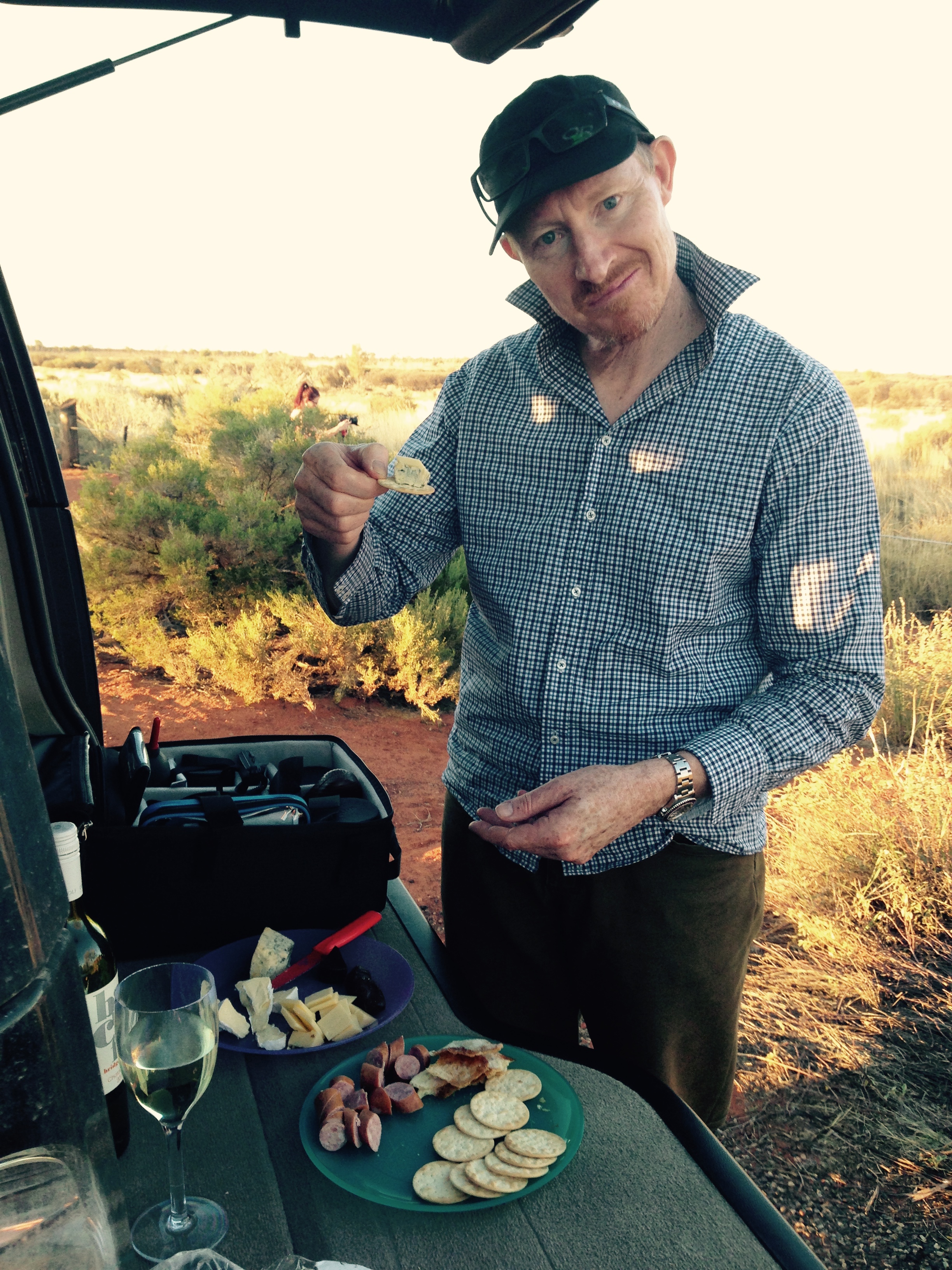
- Geoff preparing a few cheese and bikies with a glass of Riesling waiting the sunset to occur at Uluru which is over Geoff’s left shoulder in this iPhone shot.
Notwithstanding a little dig at Voda’s network coverage in the bush, we made it to the amazing rock, Uluru …and let’s not forget Kata Tjuta (Olgas)! Rising out of a flat desert like a giant red whale it has a certain magical presence that gives you a shiver even as you join the vast flotsam & jetsam of motorhomes, 4WD’s, Caravans and bikers making their way to the viewing areas. We pulled up early and got a good spot with our cheese and bikkies, while Geoff setup for a sunset photo or two. Once again, we had featureless skies, however the sunset made a beautiful blue hue around the rock as the sun dipped past the horizon. (click here to see them in high res on Geoff’s Flickr page)

Coming into Kata Tjuka main entrance road in the D4. A photo from the back seat. The road sign you can see on the right pointing to the left is to Perth via Warburton WA – the first 360 odd Kms deep rich red dirt and known as a rough track.
On another day staying at Uluru, we headed west out approx 70kms to see the Olga’s and do one of the more popular hikes into the various chasms Kata Tjuta has to offer. It was a hot day and quite popular with many international tourists all with cameras and video equipment – many of which also had their non-self respecting selfie sticks snapping away like crazy. (What’s with everyone and selfies nowadays – time for a philosophical discussion another time) 🙂
For those whom may not know, there are 36 individual domes that make up Kata Tjuta which cover an area of 21.68 km2 (8.37 sq mi) and are made up of conglomerate, a sedimentary rock consisting of cobbles and boulders of varying rock types including granite and basalt, cemented by a matrix of sandstone – mostly all in a deep red/orange colour that changes as per the sunlight.
Kings Canyon
We all got up rather early before sunrise to do the Kings Canyon Rim walk. A beautifully cool and quiet time of morning before the heat of the day, the flies, and importantly, ahead of the many tour groups that do this popular 3.5hr walk this time of the year. 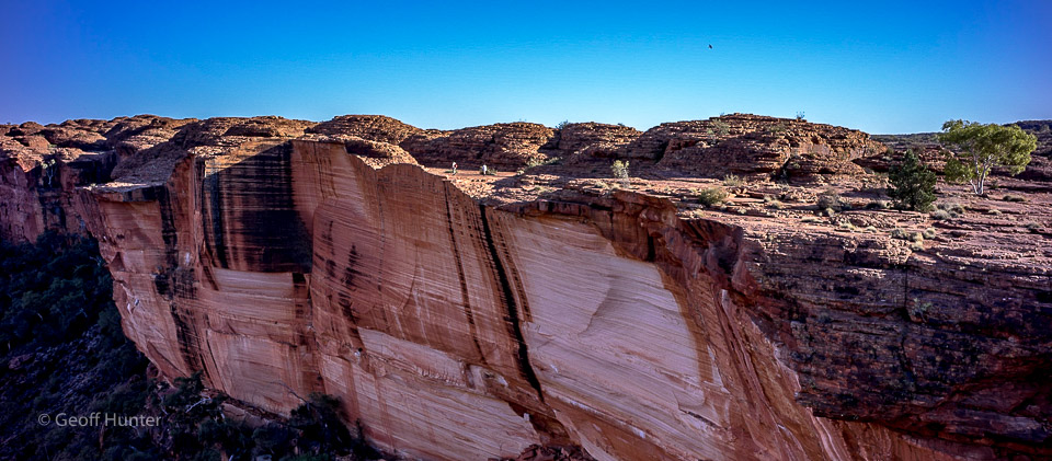
It was a challenging ‘up’ to start with, but once on the ‘rim’ it was straightforward. Such spectacular sheer drop offs with no rails or fences! Many layers of the red sandstone, fractured and crisscrossing the landscape, it was quite amazing. I wish one of us had been a geologist!
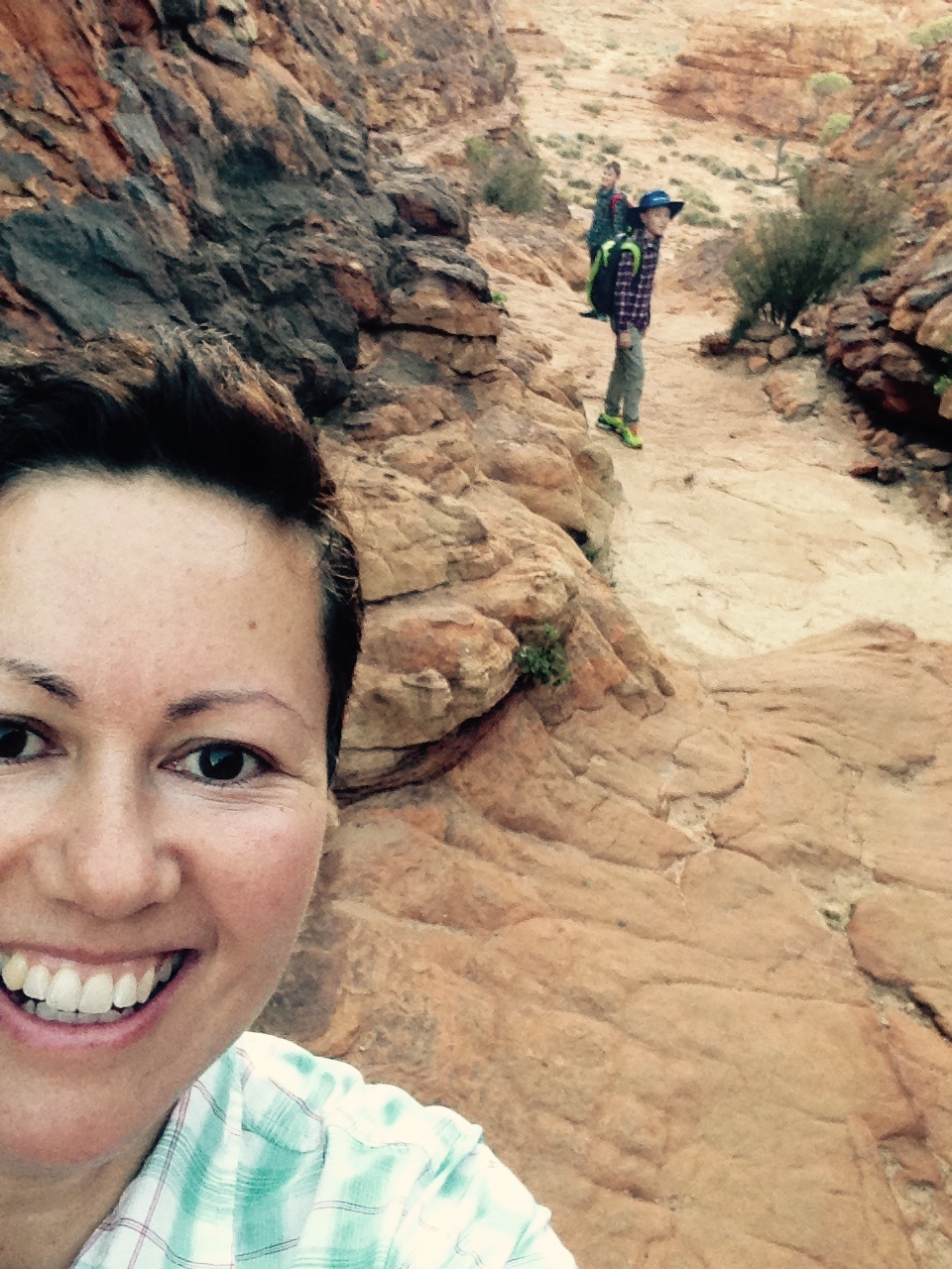
Look at those perly’s 🙂 ” A celia’fe whilst walking among the layers of history”
Coolabah trees jammed themselves into cracks, and a deep, narrow, water filled pool called the Garden of Eden, surrounded by cool greenery, complete with chirping birds, rock wallabies, frogs and a sense of tranquility. One of the most beautiful and unusual walks I’ve ever been on, it reminded me of the lost city of Petra, Jordan.
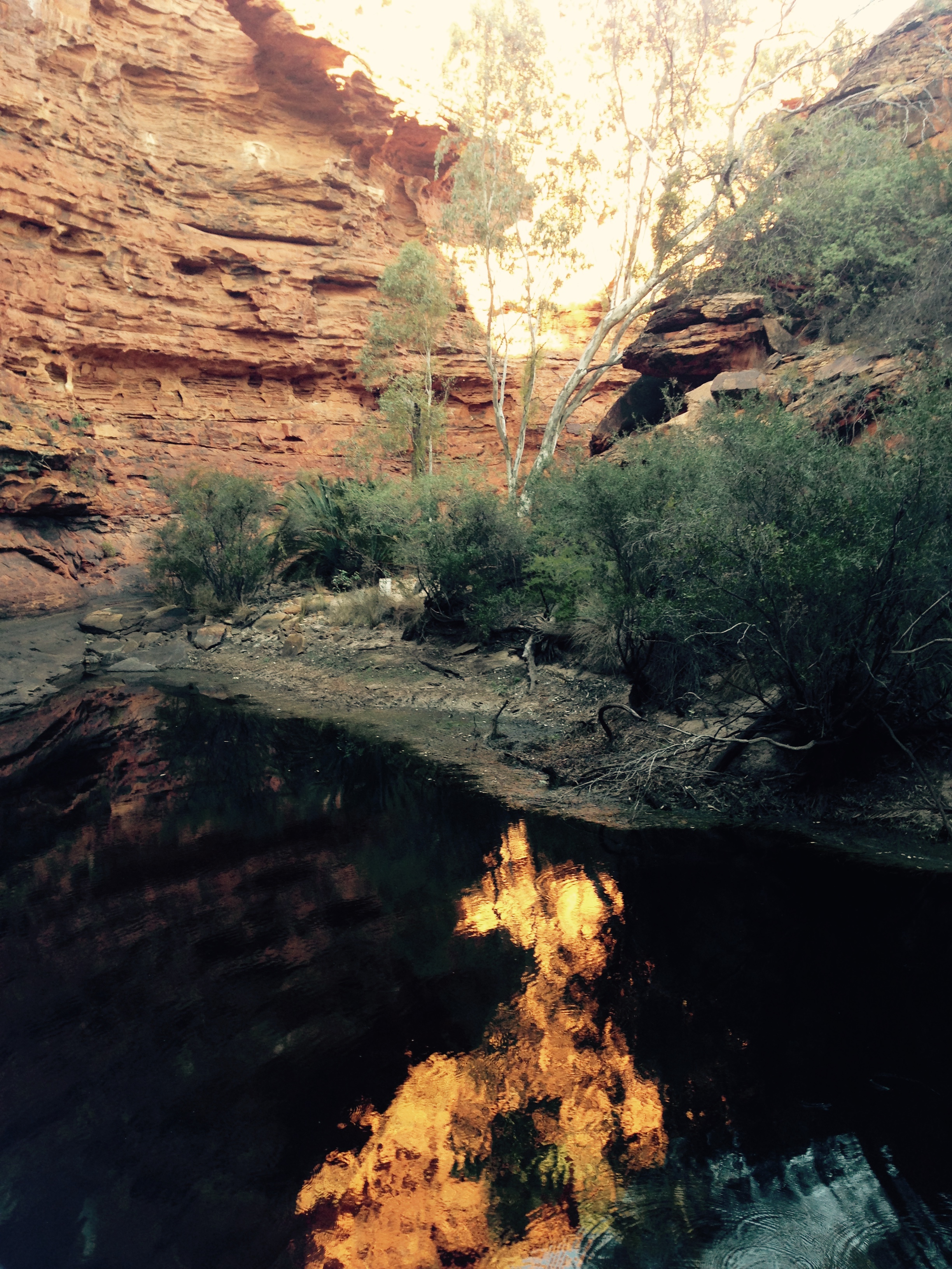
Geoff was a little disappointed photographically as there were featureless skies yet again …still, the light was golden and beautiful. Here’s one of his shots from the walk.

“Kings Canyon Sunrise” (copyright Geoff Hunter – 2015)

Leave a comment